Executive Summary
In the early hours of Monday, August 3, 2026, a moderate earthquake struck northeastern Egypt near the city of Suez. The event occurred at approximately 00:00:33–00:00:34 UTC (03:00 local Cairo time, Eastern European Summer Time). International and national agencies reported magnitudes ranging from 5.0 to 5.6, with the United States Geological Survey (USGS) listing values around 5.0–5.3 and Egypt’s National Research Institute of Astronomy and Geophysics (NRIAG) reporting figures up to 5.5–5.6 in successive updates. Depth was consistently given as approximately 10 km (shallow).
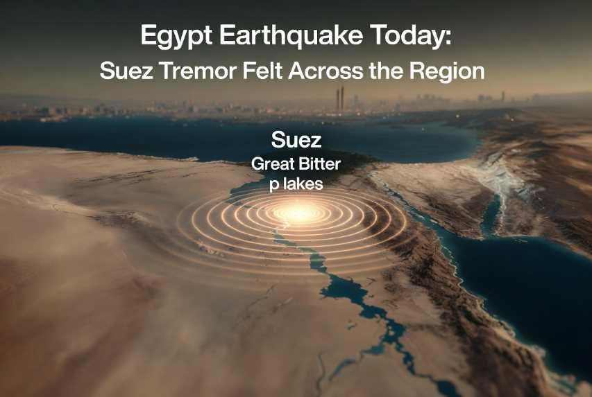
The epicenter lay roughly 36–41 km north-northeast of Suez in the Ismailia Governorate area, near Fāyīd and the Great Bitter Lakes region of the Suez Canal corridor. Shaking was widely felt across Greater Cairo, the Canal Zone, and parts of neighboring countries including the Palestinian territories, and Jordan.
As of several hours after the event, Egyptian authorities, the Egyptian Red Crescent, and the Ministry of Health reported no confirmed casualties, no significant structural damage, and no major infrastructure failures. Emergency response plans were activated as a precaution. The situation remains under active monitoring; updates may continue as full assessments are completed and aftershock sequences are evaluated. This was a moderate event by global standards but notable for Egypt, where strong earthquakes are relatively infrequent.
Earthquake Overview
The earthquake struck at 00:00:33 UTC on 3 August 2026. Preferred coordinates from major agencies cluster around 30.29°N–30.32°N and 32.61°E–32.68°E. Depth was 10 km, classifying it as a shallow crustal event capable of producing stronger surface shaking than a deeper quake of similar magnitude.
Magnitude estimates varied slightly in the first hours, as is common while data from global and regional networks are refined:
USGS reported values in the 5.0–5.3 range (mww and mb).
European-Mediterranean Seismological Centre (EMSC) listed approximately 5.2.
NRIAG (Egypt) issued figures of 5.2 initially, later revised upward toward 5.5 in some statements.
German Research Centre for Geosciences (GFZ) reported around 5.4.
The event is associated with the complex tectonics of the northern Red Sea–Suez Rift system. The Gulf of Suez is a failed rift arm linked to the opening of the Red Sea. Stress is accommodated primarily by normal faulting and related structures in the Cairo–Suez district. Intensity near the epicenter reached moderate levels (approximately V on the Modified Mercalli Intensity scale), with weaker shaking extending more than 100 km. Residents in Cairo (roughly 110–120 km distant) reported clear, multi-second shaking that awakened many people. Reports also came from Ismailia, Port Said, and farther afield.
Shaking duration was typically described by witnesses as lasting several seconds. The event was felt over a broad area encompassing tens of millions of people in Egypt and neighboring regions.
Latest Situation
As of the morning of 3 August 2026 (several hours post-event), official reports from Egyptian authorities indicated:
No confirmed fatalities or serious injuries.
No verified reports of collapsed buildings or major structural damage.
No significant power outages, widespread internet disruptions, or transportation paralysis attributed to the earthquake.
Airports, including those serving Cairo and the Canal Zone, continued normal operations.
Schools and businesses were expected to open as usual later in the day, pending any local inspections of older structures.
The Ministry of Health placed emergency and ambulance services on maximum preparedness and activated the national crisis operations room.
The Egyptian Red Crescent activated its response plan in affected governorates and advised residents to avoid visibly damaged or dilapidated buildings while monitoring official channels.
Rescue operations were limited to precautionary readiness rather than active search-and-rescue for trapped persons. Authorities continued field assessments. Information remains preliminary; fuller damage surveys and aftershock statistics will refine the picture in coming hours and days.
Interactive Timeline
00:00:33–00:00:34 UTC (03:00 local): Mainshock occurs near Suez.
Within minutes: Automated detections by global networks (USGS, EMSC, GFZ); public reports begin flooding social media and “Did You Feel It?” systems.
First hour: NRIAG and international agencies issue initial magnitude and location parameters. Egyptian authorities activate emergency protocols.
Subsequent hours: Magnitude revisions; confirmation of no major damage or casualties; reports of minor aftershocks; public safety advisories issued by Red Crescent and Health Ministry.
Ongoing: Continuous seismic monitoring, field inspections, and aftershock tracking.
Geological Explanation
This earthquake occurred within the broader Africa–Arabia plate boundary system. The Arabian Plate moves northward relative to the African Plate, opening the Red Sea and creating the Gulf of Aqaba–Dead Sea Transform fault system to the east. The Gulf of Suez represents a northwestern arm of this rifting that largely failed to fully open into a new ocean basin. Residual extension and related strike-slip and normal faulting continue to generate seismicity in the Cairo–Suez and northern Red Sea regions.
The 10 km depth is consistent with upper-crustal faulting. Historical seismicity in the area includes moderate events, though large destructive earthquakes are less frequent than along the Dead Sea Transform or Hellenic Arc. Egypt’s overall seismic hazard is moderate compared with Turkey or Iran, yet local soil conditions (soft sediments in the Nile Delta and Canal Zone) can amplify shaking.
Affected Countries
Egypt experienced the strongest effects. Primary impact zone: Suez, Ismailia, and nearby communities. Greater Cairo felt clear shaking. Population centers potentially affected include several million residents in the Canal Zone and the capital region. Infrastructure (Suez Canal, roads, older urban fabric) was monitored but no major disruptions were reported. Hospitals remained operational and on elevated alert.
Neighboring areas in the Palestinian territories, and Jordan recorded lighter shaking. No significant damage or casualties were reported from these territories. The event served as a reminder of shared regional seismic risk along the northern Red Sea and Levant.
Maps and Geographic Description
The epicenter sits in a relatively flat to gently undulating coastal-plain and canal-adjacent landscape north of the Gulf of Suez and west of the Sinai Peninsula. Nearby cities include Suez (south), Ismailia, and Fāyīd. Cairo lies approximately 110–120 km to the west-southwest. The Red Sea and Gulf of Suez lie to the south; the Mediterranean is farther north via the Canal. Active structures of the Suez Rift system and related faults underlie the region.
Aftershocks
NRIAG reported recording several (approximately five) minor aftershocks in the hours following the mainshock. Aftershock sequences are expected after an event of this size. Probability of additional felt aftershocks decreases with time but remains elevated for days to weeks. Residents should treat any further shaking with the same caution as the main event. Stronger aftershocks, while less likely, cannot be ruled out entirely.
Tsunami Assessment
No tsunami warning was issued. The epicenter was onshore or very nearshore in a shallow, restricted waterway (Suez Canal / Bitter Lakes area) rather than the open ocean. Magnitude and mechanism were insufficient to generate a significant tsunami. Coastal authorities monitored but observed no anomalous waves.
Scientific Analysis
A magnitude ~5.0–5.5 earthquake releases energy on the order of tens to hundreds of kilotons of TNT equivalent (rough order-of-magnitude comparison). Seismic waves (P, S, and surface waves) propagated efficiently through the crust, producing the felt intensities. Peak ground accelerations near the epicenter would have been moderate; farther away they attenuated rapidly. Seismographs across the Mediterranean and Middle East recorded clear signals. Comparison with historical Egyptian events shows this was stronger than typical background seismicity but smaller than the destructive 1992 Cairo earthquake (M 5.8).
Historical Context
Egypt’s most damaging modern earthquake remains the 12 October 1992 event near Cairo (M 5.8), which caused hundreds of deaths, largely due to the collapse of poorly constructed buildings. Other notable regional events include activity along the Dead Sea Transform and the 1995 Gulf of Aqaba earthquake. Lessons from 1992 emphasized building-code enforcement, public education, and rapid emergency activation—measures that appear to have been applied promptly in 2026.
Emergency Response
Egyptian civil defense, Health Ministry, and Red Crescent activated plans within minutes to hours. Hospitals were placed on high alert, ambulance services elevated, and public advisories issued. No large-scale international assistance was required given the absence of major damage. Military and civil protection units stood ready for any emerging needs. Humanitarian organizations monitored the situation.
Public Safety Advice
During aftershocks: Drop, Cover, and Hold On. Stay away from windows, exterior walls, and unsecured objects.
Inspect homes for new cracks, especially in older masonry. If structural concerns exist, seek professional evaluation before re-entering.
Prepare or refresh emergency kits (water, food, medications, flashlight, radio, documents).
Establish family communication plans that do not rely solely on overloaded mobile networks.
Avoid unnecessary travel in the immediate epicentral area until assessments are complete.
Follow only official government and scientific sources for updates.
Economic Impact
With no confirmed major damage, direct economic losses appear limited. Temporary business interruptions in the Canal Zone or Cairo were minor. The Suez Canal itself, a critical global trade artery, reported no operational impact. Tourism, energy facilities, and ports showed no significant disruption. Insurance claims, if any, are expected to be modest. Longer-term effects hinge on any discovered hidden damage or aftershock impacts.
Technology Used
Modern seismic networks (USGS, EMSC, NRIAG, GFZ) provided rapid detection and location. Smartphone early-warning systems alerted some users seconds before strong shaking arrived. Crowdsourced “felt” reports via apps and social media rapidly mapped intensity. Satellite and aerial imagery, GPS, and potential drone surveys support damage assessment. AI tools increasingly assist in analyzing imagery and prioritizing inspections. Emergency communication systems and official channels disseminated verified information.
Climate and Environmental Effects
No widespread landslides, liquefaction, or ground rupture were reported in initial assessments. Soft sediments near the Canal and Nile Delta can amplify shaking and, in extreme cases, promote liquefaction; monitoring continues. Dam and water-system integrity was checked as standard procedure. Environmental risks remain low given the moderate size and lack of reported surface effects.
Frequently Asked Questions (FAQ)
Why did the earthquake happen? It resulted from stress release on faults within the Suez Rift system linked to Africa–Arabia plate interactions.
Will more aftershocks occur? Yes, minor aftershocks are expected and have already been recorded. Their frequency and size typically decline over time.
Can earthquakes be predicted? Precise short-term prediction is not currently possible. Probabilistic forecasts and early-warning systems exist.
Is another major earthquake expected soon? No reliable short-term forecast exists. The region has ongoing moderate seismic potential.
How are magnitudes measured? Through analysis of seismic wave amplitudes and periods recorded on global networks (moment magnitude preferred for larger events).
What should residents do now? Remain vigilant for aftershocks, inspect buildings, follow official advice, and prepare emergency supplies.
Was there a tsunami risk? No.
Why was shaking felt so far away? Shallow depth and efficient wave propagation through regional crust.
How does this compare with the 1992 Cairo quake? Similar magnitude range but lower impact due to location, timing, and improved preparedness.
Are buildings in Cairo safe? Most modern structures performed well; older or poorly maintained buildings warrant inspection if cracks appear.
Did the Suez Canal suffer damage? No reports of operational impact.
How many people felt it? Tens of millions across Egypt and neighboring areas, based on population density and felt reports.
What is the tectonic setting of the Middle East? Complex interactions among African, Arabian, Eurasian, and Anatolian plates produce varied fault systems.
How can I stay informed? Follow NRIAG, official Egyptian civil protection, USGS, and EMSC updates.
Should I leave the area? Not unless authorities issue specific evacuation orders or your building shows clear structural distress.
Expert Opinions
Seismologists from NRIAG emphasized continuous monitoring and the normal occurrence of aftershocks. International agencies noted the event as consistent with known regional seismicity. Disaster-management officials highlighted the value of rapid activation of emergency plans even when damage proves limited. Government statements stressed that the health system remained stable and that assessments were ongoing.
Future Monitoring
Seismic networks will continue dense monitoring of the aftershock sequence. Scientific teams may deploy additional instruments or analyze existing data for fault mechanism and stress transfer. Long-term risk assessments for the Cairo–Suez corridor will incorporate this event. Public updates are expected as new data become available.
The 3 August 2026 earthquake near Suez was a moderate, shallow crustal event that produced widely felt shaking across northeastern Egypt and adjacent regions yet caused no confirmed casualties or major damage according to authorities in the hours following the mainshock. It underscores both the persistent seismic hazard of the northern Red Sea–Suez tectonic system and the benefits of preparedness, rapid official response, and modern monitoring technology. Recovery, if any localized repairs are needed, is expected to be straightforward. The episode serves as a timely reminder for residents and planners across the Middle East to maintain earthquake readiness, enforce building standards, and support continued investment in seismic networks and public education. Information remains subject to refinement as full evaluations conclude.
 |  |  |